|
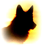
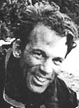
Douglas Gordon
(1956-1998) |
|
Douglas
Gordon
|
On October 16,1998 Douglas
Gordon lost his life on the Tsang Po River in Tibet. Doug was
participating in a
National Geographic Society sponsored expedition in the Tsang Po
Gorge in the eastern Himalaya Mountains.
Read More >
|
River Devil
DXpedition
Download River Devil
DXpedition
Google Earth
placemarks [43 kb zip file]
for the entire
Dxpedition
route [Version 1.0 prepared on October 7, 2006]. This is just a
preliminary survey. We need to opt for a downstream Dxpedition. So
please 'Reverse Order' the points if you feel like! You need to have
Google Earth
to open the KMZ files.
|
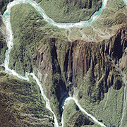
Tsangpo Gorge (Tibet)
View
IKONOS
satellite
high resolution image
of
Tsangpo Gorge
|
Why Tsangpo Gorge?
Tibetans believe that the entire Tsangpo Gorge area with the Hidden
waterfall, 25,445 feet Namcha Barwa to the South & 23901 feet Gyala Pali
to the North are the parts of a living goddess. Namcha Barwa and
GyalaPali are her two breasts...the river her spine. In the event of the Earth
self-destructing itself, people from the extinct world would sneak
away to take refuge in her for their life. The only safe place on earth
with waters so pure.
Read
Arthur C. Clarke short story:
The Nine Billion Names of God |
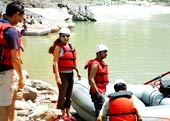
Tsangpo
Expedition
Liquid Thunder
'It's the cradle of Shangri-la, and
one of the deepest river gorges on earth. It's a fortress guarding
sacred waterfalls, and a cauldron of savage whitewater and unrunnable
rapids. In the chill of the Himalayan winter, seven world-class
kayakers led a massive expedition into the shadowy realm of Tibet's
Tsangpo River , and launched their boats down its roaring throat. They
were either going to die�or emerge transformed'-Peter Heller (OUTSIDE)
Read More >
|
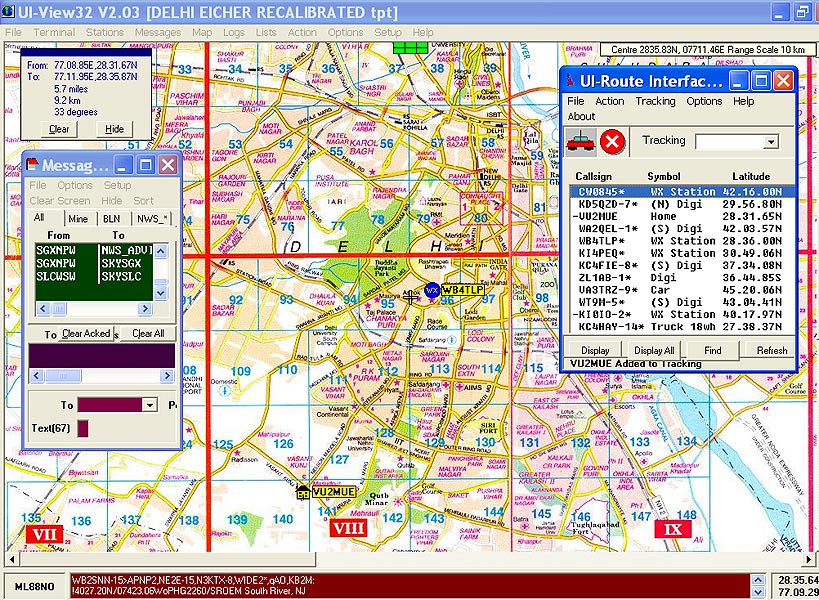
Instructions to use
the map:
[1]
Wait for the map to fully load
[2] If you get a message like 'allow
the Signed Java Applet to run'. Do that by clicking 'OK' or 'YES'. It is
safe.
[3] Click on the map to activate
JAVA control.
[4] Initially when you see the map,
you may not see my station icon (my call-sign). This means I have not
yet sent my position beacon. Have patience till your browser receives
the beacon. In the meantime you can do other works in your computer.
Even if I don't appear, say, after 3-4 minutes, this means my systems
are off. That's why ask you to fix up a schedule with me for a demo.
[5] When you see my icon with the call-sign on the map, 'CLICK' it. You
can see a small text line below the map where my positions and other
TEXT MESSAGE appear.
[6] You can read messages at the 'Java Console'. To read messages. Click
press the 'M' key on your computer keyboard. Now you can open the JAVA
CONSOLE from your Internet Explorer Browser's TOOLS > SUN JAVA CONSOLE
|
APRS Presentations & Lectures
VU2MUE's personal documentation page archiving his various achievements
an credentials
|
|
|
Why javAPRS?
This page uses
Peter Loveall's (AE5PL)
javAPRS [javAPRS
2.7b24 � 2006 Pete Loveall AE5PL] to
demonstrate ham to non-ham communication (Non-hams can only
monitor APRS ham activities using their Internet Browsers) which
definitely have utility during any emergency situation, like the proposed
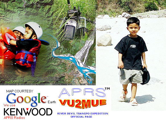
River Devil Dxpedition to
Tsangpo Gorge.
During the demo,
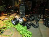
VU2MUE
feeds the real-time RF (Radio Frequency) data via a
KENWOOD radio
interfaced to his computer and that data reaches you via the Internet
showing his positions & messages on a map (you can in fact track him if you
monitor dedicatedly). He uses
Late Roger Barker's (G4IDE) UI-VIEW to log-in to Rin Fukuda's
(JG1VGX) Tier 2
T2JAPAN APRS server
and then the data is internationally distributed from
T2JAPAN tier 2 server. VU2MUE can also remotely text message, i.e.
even if he is in his boat at a remote place where there is no Internet
connectivity or where there is no cell-phone network, he could
'text message' you! In the map below, you can see his car moving in the
streets of Delhi when he is
QRV on
APRS. If you want him to give a demo please feel free to contact River Devil at
wolfveng@riverdevil.org or call
him. River Devil Core Management Team will inform you with the schedule.
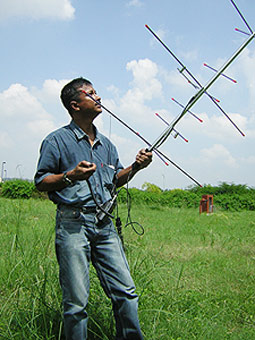
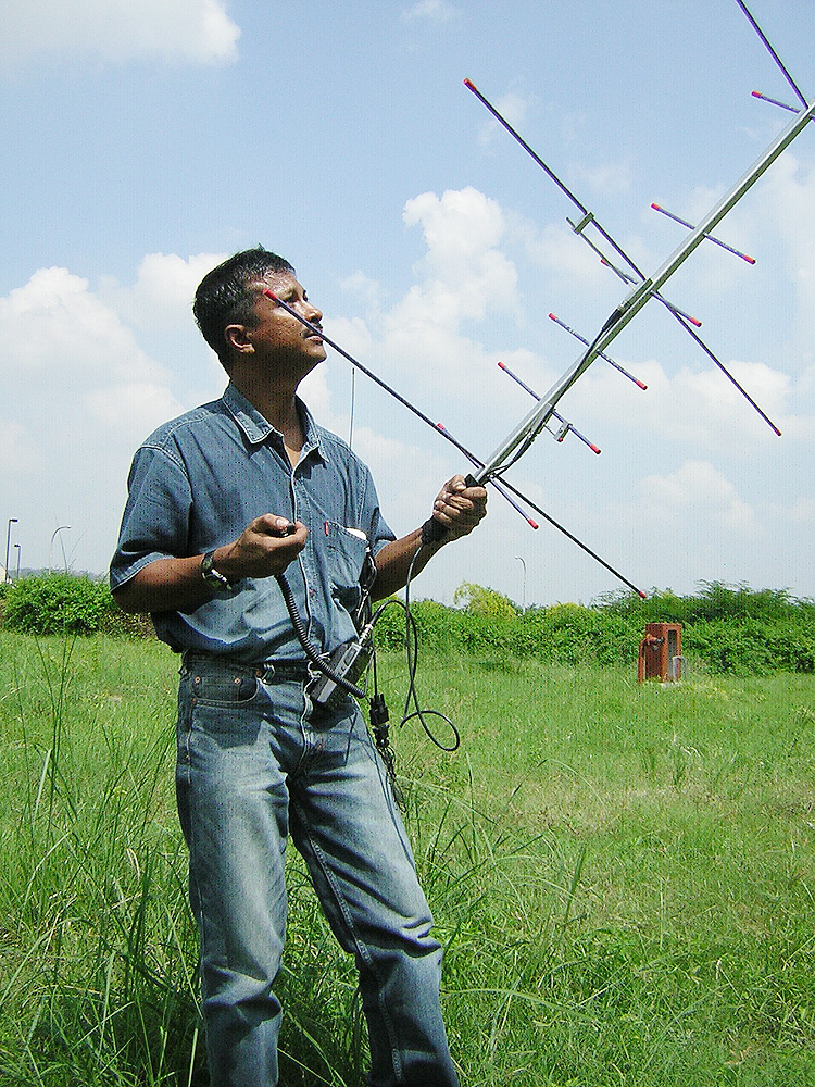
VU2MUE trying the ISS (International
Space Station)
Digipeater.
Click the image if you want it big! A few credentials of
VU2MUE
here
|
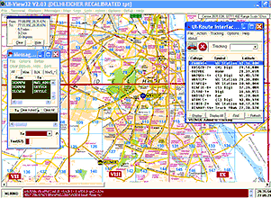
Click the image for high resolution screen shot
Roger Barker's
(G4IDE) UI-VIEW is a popular Windows based APRS application
used by hams (radio amateurs licensed by the government) all over the
world. UI-VIEW requires a validation from APRS server administrators.
Being a ham I always appreciate others also to become hams so that
they can also use a beautiful software like UI-VIEW and enjoy the
benefits of APRS Technology. Hams in Asia region can contact
Art
Takashi, JA1OGS for APRS Server validation.
Art
Takashi, JA1OGS is the official Registrar for Region-3
Asian countries.
javAPRS enables the demonstration of Amateur Radio APRS
capability to the non-hams who does not have UI-VIEW (or any other
APRS applications) installed in his/her computer. The map that appears below is an APRS map
accessible by the non hams too. Text messages originated from RF
stations can also be monitored by non-hams which has a utility in
ham radio emergency communication [press 'M' and the read
message at JAVA Console].
Peter Loveall
(AE5PL) during a repeater installation. Peter Loveall took
over the javAPRS support from
Steve Dimse,
K4HD.
|

|
Click here to see
the River Devil Expedition metaphorical Inauguration Point (If we
start upstream!) which is
73.71 km north east of Dibrugarh or
click here to download KMZ
file to view in Google Earth. [ MIME type for kmz file download
not yet added to my server. Rename the file with KMZ after you
download it
].
You Need to download
Google Earth
to view the location
|
|
There are many
place marks of significance. For example
Click here to see the
bridge that we saw near Linzhi Airport in TIBET.
click here to
download the KMZ file to open the placemark in Google Earth.
This is the only bridge that we located during the entire course of
our expedition.
[After
downloading, rename the file with KMZ extension]
|
Download River Devil
place-marks for the entire expedition route (Verion 1.0).
Places where River Devil intends
to stop
|
Download River
Devil place-marks for the entire expedition route (Version 1.1). Places
where River Devil tries to trace the entire course of the expedition
route
|
|
.gif)